Showing posts with label Adventure. Show all posts

Thursday, 8 October 2015

Exploring Sarve, Part 5 - Bibi's Legacy

My second day at Sarve was spent mostly idling around the village and talking to some of the villagers about Sarve.

The original plan was to watch the sunrise from over a small hill at the northen end. That was junked as soon as I realized that I had overslept. My Pune mates had already departed due to some work back home and I was to myself for the day. After a quick breakfast at Mt. Kifayat’s house, Nasir escorted me back to his own house where Mr. Sabir was already waiting for me.

The sun was up to and the sea-breeze was yet to pick up. We decided to start the warm day with a walk along the shore northwards, and then return via the main street. One of the prominent landmarks of the shore is the skeleton of a whale that had beached here a few years ago. The sheer size of the skeleton is amazing. This one is probably bigger than the one kept in the Ratnagiri aquarium.

A whale vertebra

Further north, we came upon a natural pool that was completely taken over by a herd of buffaloes. Our presence was duly resented and we started our way back.

Moooo ...

I departed Sarve after another hearty lunch with a combination of bike ride, hitchhike and bus ride.

The way back home

Bibi:

One of the persons we met on our way back casually spoke about Bibi Mukadam as one of the famous people from Sarve. The name never registered in my head, until Mr. Sabir brought up the topic again during lunch at this place. According to him, Bibi Mukadam lived in the village in a political exile from her homeland of South Africa where she was a prominent part of the anti-apartheid movement under Nelson Mandela. She was also a friend of the late Mrs. Indira Gandhi, who had visited her at Sarve during her Prime Ministerial days without any security detail. I made a note of this story with a point of exploring in detail once I got home.

-x-x-x-

Born as Ms. Ayesha Bibi Dawood in Worcester, South Africa,  she later married a seaman Mr. Yusuf Mukadam from Sarve, India. The details of her life are well documented by the South African government ( Link 1 ; Link 2 ). This is a very exciting discovery, especially since there is hardly any mention or knowledge that such a person existed and made a remote corner of our country her home for most of her life.

Recognition by the Government of South Africa

Mr. Sabir’s words ring out clearly here: “She lived among us as one of us. Yet when one was around her one could feel greatness exude from herself. The way she carried herself clearly marked her as a prominent person. Yet, we did not know who she was. Nor did she ever tell herself.”

Bibi returned to the country of her birth in the 1990s. After her death, a steady trickle of journalists from South Africa happened to make their way to Sarve. That’s when the real magnitude of her greatness dawned on the people. Yet today her story is not well known even in Sarve.

Let’s hope for the best – for Bibi’s legacy and for Sarve…

© Kapil Pilankar

Thursday, 1 October 2015

Exploring Sarve, Part 4 - Of Fishes and Govinda

Our evening at Sarve was flowing along as we chatted about our lives, our work, our worlds and our universe ... a full 42 conversation. the lazy flow of the evening was interrupted when Mr. Sabir asked us to get ready for the activity of the night - fishing!

Something Fishy ...

We accompanied him as he went to check on his net that he had cast neat the shallow pools. Wading through knee deep water, we made our way to the net. There was a fish, locally called ‘hausa’, which was caught in the net. It has a sharp dorsal fin equipped with a sting that hurts like that of a scorpion’s. Mr. Sabir carefully untangled it from the net and kept it on the dry rocks nearby, while we continued onward to inspect the rest of the net.

The Hausa

Here we found a few crabs and one water-snake which were also caught in the net. Mr. Sabir gave us a lesson crab-catching. The only way to safely catch a ‪crab‬ is by gently pushing the head so that it just stops in its tracks and then carefully bundle the ‪‎claws‬ in. In such a position they are mostly harmless.

Crab catching

We returned to the house with our catch - ‘hausa’. That fish would fetch about Rs. 150-200 if sold to the Kunbi casts people. Kolis and Muslims will not pay even Rs. 10 for it, we were told.

Older catch - hausa and boi - now frozen


Gooovindaaa re Gooopala ...

We had a light vegetarian dinner after which we made our way to Mr. Kifayat’s house, where we were to spend the night. His house was at the other end of the village and the short walk almost seemed like a guided tour of the village itself. Another relaxed session of chatting ensued - this time our religion and beliefs were added to the general mix. This session lasted till almost midnight, when we again left the house to attend the Janmasthami celebrations at the village temple.

We made our way to the temple and were greeted by the Sarpanch and other elders. The ex-Sarpanch sat with us and gave a brief account of the village conditions and customs. A quick cup of black tea was served as the puja began with the priest narrating a dramatic account of the birth of Lord Krishna. The fervor of his pitch steadily rose as the time of Lord’s birth drew near. The main aarti started sharp at midnight. This was followed by a short procession of village kids dancing along to ‘goooooooovindaaa re goooopaalaaa …’.


We joined the fun and were quickly drenched as the villagers threw bucket after bucket of water on the kids and by extension us too.


After a while we excused ourselves and returned back to Mr. Kifayat's house for some much needed rest after a long but fun day.

© Kapil Pilankar

Saturday, 26 September 2015

Exploring Sarve, Part 3 - A Hidden Cascade

We are at Mr. Sabir’s place after the seeing the viewpoints. He has to attend an urgent meeting in the village and takes our leave. Shortly, Nasir and Jamil, sons of Mr. Sabir and Mr. Kifayat respectively, make an appearance. Nasir, as described earlier, studies in the local ITI. They are to guide us to a waterfall located about 30 minutes inland. Mr. Sabir’s youngest daughter, Mantshaa, would also accompany us.

The waterfall is to the south-east of the village. We cross the small stream just beyond the last of the houses that is fed by the waterfall and ascend along the left (southern) bank. The path makes its way gradually in to the thick forest. We pass a small waterfall along the way followed by a small meadow of pink wildflowers. The forest is denser from here on.

Pink bloom

Out path is blocked twice by huge spider webs under which we duck to pass through.

The spider guardian

The path has overgrown bushes throughout. Nasir has carried a sickle for precisely this task and clears them. The path, it seems, was not used frequently.

Clearing up the path

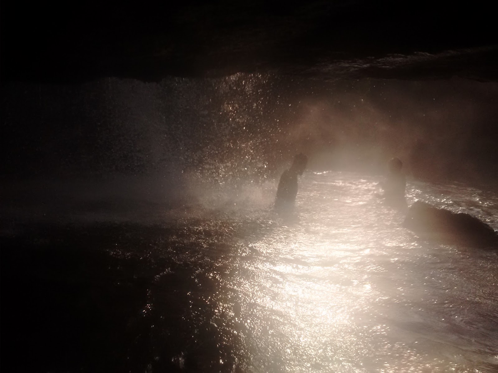
The roar of the waterfall announced its proximity before we had an opportunity to see it. Even then, the waterfall had us in awe once we saw it. Water fell heavily from a stream for about 100 feet into a pool of clear water. The pool was not too deep and was safe for a quick dip. Behind the waterfall, the waters had carved out a very cozy cavern.

The waterfall and the small cavern

We lazed around the waterfall for a good part of the hour before our guides decided it was time we moved on. The waterfall belonged to the forest folks after dark - peacocks and other birds, deer, boar and leopards.

A view from the cavern

After descending about halfway through the trail, our guides asked us to halt for some time and promptly disappeared along a side trail. Waiting for about 15 minutes, and hearing their not so distant voices, got the better of my curiosity and I decided to follow. To my surprise, I saw Jamil halfway up a coconut tree, trying to desperately scythe free some fresh coconuts for the lot of us. Nasir, wearing jeans, belted instructions from below. It was quite a scene.

Caught in the act ... 

The duo returned with their loot of one coconut for each of us. i tried my luck with scything open one, but it ultimately had to be done by Nasir.

Nasir scything coconuts

Jamil in action

As we returned to the main road, the sun had already painted the sky crimson-orange as it prepared to set. We sat down on a grassy knoll to watch the view as peacocks kee-oik-ed in the distance.

Evening colours

The setting sun

By the time we returned to Mr. Sabir’s house, the last of the evening light was cast over the horizon. We freshened up and settled down for a lazy evening chat.

Twilight by the sea ...

© Kapil Pilankar

Sunday, 20 September 2015

Exploring Sarve, Part 2 - A Lighthouse, Two Forts and A Healer

The Lighthouse

Post lunch, we drift into small talk to keep off the slumber. A little while later, we are on our way to the village of Nanivali, further north on the road to Dighi. Mr. Sabir tells us there are amazing view-points along the road.

As soon as we leave Sarve, the road winds up a steep incline. The village of Nanivali is located a higher elevation, yet lies along the shore. A kilometer before the village is the first viewpoint which offers a view of the Dighi lighthouse.

The lighthouse

This lighthouse assumes significance due to the high activity at the Dighi Port and the rocky shores around it. There’s no direct road to the light house and one has to trek a distance of about 200mts from the last road head. From the village of Sarve, the lighthouse is an enjoyable trek of about two hours over a part rocky, part sandy, part uphill route right next to the shoreline.

The Two Forts

The second view-point is just outside the Nanivali village. Standing here, one can view the majestic Janjira fort and the relatively isolated and unknown Padmadurg in a single field of view - though not on camera. The entire Murud village is seen from this spot.

Janjira, with Murud in the background

The fort of Janjira, as described earlier, was the heart of the Siddi kingdom. The mighty fortress has stayed undefeated till Indian independence, after which it was integrated into the Indian state. With its integration, the inhabitants of the island fort gradually returned to the mainland, leaving the fort into the hands of nature and the beleaguered ASI. Sixty years of negligence has taken a great toll on the fort, yet it stands as majestic as ever.

Padmadurg  - a faint speck in the distance

Padmadurg, on the other hand was built by the Marathas with the sole purpose of defeating Janjira. Legend goes that the fort was completed in a night, since by day the Siddi troops would attack and destroy whatever progress was made. Marathas, under the leadership of Sambhaji Maharaj almost accounted for Janjira when an attack from the north by Aurangzeb forced them to divert their attention there.

The Healer

On our way back, we stop by an isolated hut with an aim to get a better photo of the lighthouse.

The hut with a view ...

The hut belongs to a local healer from Nanivali. This man is a thinly built sexagenarian with a failing vision, yet as sprightly as a lamb. He relies on the traditional arts of healing handed over from generations and in return expects just a token of coconut as a payment.

The entrance to the hut

The cowshed

Throughout our conversation he emphasizes the importance of time in the medical practice, a fact that sadly escapes many in the modern medical setup as is so frequently observed.

We take their leave and return to Mr. Sabir's place.

© Kapil Pilankar

Friday, 18 September 2015

Hampta Pass, Part 4: Day3 Ferpatthar-Pritam's Shoes-Balu Ka Gera

Day3: Ferpatthar-Balu Ka Gera-Hampta Pass-Shia Goru (Part 1 of 3)

It was a gloomy morning on the third day of the trek. The weather had not improved one bit. Not one member from out team was out of their tents that morning, even after 7am. In a quick conference with Dinesh, it was decided that if the weather did not improve by 9am, then we would drop the planned ascent and the subsequent crossing of the Hampta Pass and descend all the way to Jobri.

A gloomy start
PC: Arpit Shah

Pritam had by this time all but resigned to the fact that he would have to return from that point itself due to the sore condition of his shoes. What we did not know was that Dinesh and Roshan had literally foraged the adjoining campsites for any material that would help to fix the shoes. Eventually, the left over Fevibond , some duct tape sourced from other camp and some cotton sling which I was carrying were used to prepare a set that, with luck, would last the day.

Goody Two Shoes
PC: Arpit Shah

Luck shone from another direction too. The weather started clearing up sometime after 8am and we were told to be ready for departure ASAP, lest the weather turn sour again. Pritam took some time to prepare himself – first mentally, then the actual physical preparations – when he realized that he will also be making a summit attempt.

Five members of our team of sixteen had chosen to offload their luggage on the horses today. Others also partially offloaded. The least offloaded person, it seems, was Arpit due to his preparations for the HMI training course. We started shortly after with me being the last person to leave the campsite – again.

The initial ascent
PC: Sandhya Bhatre

Our trail for the day immediately headed into snow and then alternated with grassy knolls and boulders. After about two hours into the day, we reached the actual Balu ka Gera campsite. Balu here refers to sand – not to be confused with ‘bhalu’ or bear. This campsite is an expanse of sandy plain divided into two by a tapered lake. The upper reaches of the hillock by the campsite was the only dry spot and we took a break here. The weather was now overcast, but thankfully the rains were away. From here on it was to be a stiff ascent to Hampta Pass top.

Balu Ka Gera
PC: Arpit Shah

Our first steep ascent through the snow was punctuated by a steep rocky ascent at its peak. The weather had started to deteriorate led by a drizzle with a mild breeze. The goat-herds overtook us here and assured (?) us that there was still a long way to go. The group had by now split into two distinct groups lead by Dinesh and Roshan respectively. Dinesh’s group included Shivani and Shakeel at the lead, me and Arpit floating and the rest in the middle. Roshan’s group included Sony, Tejal and Pritam, all of whom were somewhat struggling at the rear and were mostly beyond our eyesight for most of the ascent after Balu ka Gera.

Just beyond Balu Ka Gera
PC: Arpit Shah

Today was expected to be a long day. A total distance of about 11.5km and a stiff climb. This day typically takes about 8-10 hours. We had been walking for about 4 hours now, yet were nowhere in sight of the actual Hampta Pass. We were tiring and the weather was alternating between good and bad. Mentally, this would be a killer.

... to be continued in Part 2

© Kapil Pilankar

Wednesday, 16 September 2015

Exploring Sarve, Part 1 - Introductions

Sarve, Habsan

Murud, along the coast of Raigad district in Maharashtra is a well known tourist spot famous for the impregnable and undefeated sea-fort of Janjira. The Siddi Dynasty exerted uninterrupted control over the island fort and the surrounding region - called Habsan - from the late 15th century, right up to its ascension into the Indian Republic in 1948, resisting attacks by the Marathas, British, Portuguese and the Dutch.

A little south of Murud, across the Dighi creek lies the sleepy coastal village of Sarve, also a part of the erstwhile Habsan state.

Sarve - on the map

Sarve - as it stands today - is an up and coming rural-tourism destination. The village seeks to promote a unique brand of sustainable rural tourism by relying on community support and making the best use of its available natural resources. In this, they are actively supported by the Swades Foundation and Grassroutes.

The village also has a unique identity with its association with South African anti-apartheid crusader Ayesha (Bibi) Dawood. Sadly, this important thread of history is slowly being forgotten. So much so, that I only learnt about it after being given a passing reference just ahead of my departure from the village.

The village of Sarve has three major communities - Muslims, Kolis and Kunbis (in no particular order).

Approaching Sarve

Sarve can be approached by two routes:

  • Mangaon - Mhasala - Vadavli Phata - Aadgaon - Sarve
  • Alibag/Roha - Murud - Agardanda - Ferry- Dighi - Sarve
Alibag, Roha and Mangaon are well connected to both Mumbai and Pune. The total drive from Mumbai takes about six hours, while that from Pune takes about four.

We - me and my mates from Pune - took the first route. After crossing the Velas Agaar village - not to be confused with the one in Ratnagiri famous for the turtle hatchlings - the road aligns itself right next to the coast. The rocky shore near Velas Agar - with its peculiar temple - slowly gives way to a fabulous beach at Aadgaon.

The peculiar temple at Velas Agaar - on a rock! I regret not taking a closer pic.

The Aadgaon Beach

The road climbs here, away from the shore, and then rejoins as the village of Sarve with its rocky shore falls into view.

Our Hosts

Near the first set of houses on the shore-side we are greeted by our host for the weekend, Mr. Sabir Mukadam alongwith Mr. Kifayat Chougule, our co-host. He spearheads the rural-tourism initiative of the local community and is usually the first point of contact. He is a sharp man, in mid 40s, driven by a purpose.

He had spent most of his prime in Mumbai, working hard to make his ends meet and save for the family back home. After saving enough to construct his own house, he returned to Sarve, mostly empty handed, but with a vision for the future. We met up with his family - wife and three daughters. The son, now studying in an ITI, was out and would return later in the day.

His modest house is bang on the shoreline at about 20 steps from the water, but at a safe elevation. Over lunch, he narrates a story of one of the many severe coastal storms his house has endured. We listen, enchanted by the narrative.

Mr. Sabir's House and the rocky shoreline

The lunch itself is a modest fare, in sync with the general mood of the place. Yet there’s enough opulence in hospitality that makes everything a lavish affair. The food stays vegetarian, owing to the month of Shravan. The non-vegetarian delicacies will have to be sampled next time.

Oh yes, the non-vegetarian diet primarily includes fish - caught by hands as they drift into the shallow pools formed by the rocky shoreline. We are told we would be trying that in the evening. Excited smiles abound!

Contact Info:

For bookings, Sabir Mukadam can be reached on 7588650329. Alternately, Rudes Gaikar of the Swades Foundation be reached on 9209715520.

© Kapil Pilankar

Saturday, 15 August 2015

Hampta Pass, Part3: Day2 Cheeka-Juara-Ferpatthar

Day2: Cheeka-Juara-Ferpatthar

The second day of the Hampta Pass trek usually starts at Cheeka and ends at Balu Ka Gera. We had assumed the same thing. However, much later in the day, after we had set up camp and downed tea were we told that the place where we were was actually the Ferpatthar campsite and about 2 hours hike short of Balu Ka Gera. Since, this was early in the season, the campsite at Balu Ka Gera had not completely dried out and hence would not be ideal. In any case, none of us was complaining after the already long and sapping walk.

The day, as is the norm in the Himalayas, started early and most of us were up by 5:30am. I'd had a not-so-comfortable sleep after having been relegated to the side of the tent with the bags. I'd almost used the bags as a side-pillow during the night. A slight drizzle early in the morning receded and the day eventually cleared up. We put out our slightly wet shoes, clothes and rain-shets out to dry in the sharp sun.

At the breakfast rock
L-R: Mayank, Sarita, Shivani, Sandhya, Pritam, Gauri
Uninterested: Tejal
PC: Arpit Shah

A hearty breakfast of bread, jam, honey, omelettes and porridge followed. I skipped the porridge. The condition of Pritam's shoes had deteriorated and had to be fixed with Fevi Bond and Fevi Kwik as a temporary solution. Also, bags for a few of our group were deposited on mules for the days hike to reduce their strain. We set off at about 9am after the day's instructions by Dinesh, our guide. I was the last person to leave the camp-site.

The route, Purvi & Charuta in the foreground
PC: Arpit Shah

Immediately after the campsite we had to negotiate a simple wooden drawbridge. The experience from Day1 proved handy in this case. The route quickly gained elevation along the right bank of the Allain Nala. Here we were passed by herds of sheep and goats brought by the local shepherds to cross over the Hampta Pass to Spiti - same as our route.

The sturdy Capris
PC: Sandhya Bhatre


Tejal was facing trouble with the stiff hike and so we exchanged bags. Mine was the lighter one. This might have just marginally helped, for soon we had our first snow traverse. The snow was stale, and being on a regularly used path, had taken on a dull colour. The traverse was done without any issue. The elevation of the path eased on from here on.

The "snow"
PC: Arpit Shah

Then came the big highlight of the day - crossing of an icy stream. The stream cascaded from a waterfall to our left to join the main branch of the Allain Nala on our right. The water was knee deep and icy cold. Hats off to the crew who put the rope and assisted in the crossings!

The Dreaded Crossing
VC: Arpit Shah

A 15-20 minutes walk from this crossing brought us to the Juara campsite where we had our pack lunch - plums, eggs and biscuits. The usable area at Juara is greater than that at Cheeka and hence it is also one of frequently used campsites on the route. By the time we left Juara, it was drizzling once again. The rain played on and off till we reached the Ferpatthar.

The view from the campsite
PC: Sandhya Bhatre

My pants, socks and shoes were partially wet due to the days happenings and then I'd to wait for the greater part of an hour for my bag to reappear. This was probably the last time I'd be swapping my bags with someone.

The campsite at Ferpatthar is - like Juara - very spaced out with easy slopes. Th campsite is called such due to the abundance of boulders that surround the campsite.

The rest of the day was spent relaxing by the nala and cursing the weather - dull and drizzle. A game of uno followed in the bigger tent and post dinner everyone was off to a peaceful sleep. All except Pritam, for his shoes were badly damaged and if no solution was found, he'd have to descend to Manali the next day itself without attempting the Hampta Pass. Fingers crossed ...

- Kapil Pilankar

Monday, 3 August 2015

The Aur-Khilao Amboli Trip

Aur Khilao – Aur Khilao …

A total of fifteen kanda-bhaji plates, sixteen vada-pav, ten omelets and eleven sweet-corn were consumed by our motely group of eight people under the pretext of brunch on this trip. Other notable additions were the “very much loved” Gulkand cake, an assortment of pastries from Monginis, methi pakoras, gulam jamun and fruit plate in the Konkankanya Express. We also had a lunch and two dinners apart from this... :D

About Amboli …

The things we love ... 

Amboli is a small hill-station close to the southern tip of Maharashtra at the border of the Sindhudurg and Kolhapur districts. The Amboli village lies on the highway connecting Sawantwadi in Konkan to Kolhapur and Belgaon on the Deccan Plateau and is the topmost point of the ghat of the same name.

The Amboli area receives the highest rainfall in Maharashtra state and coupled with its relatively sparse population, has a dense forest cover which harbors a variety of fauna some of which is unique to this area.

The Trip Idea

During the Vengurla Trip back in April, we had seen that bikes are available in Sawantwadi on rent. Another trip to Vengurla – for the southern stretch up to Redi/Terekhol - was on the cards, however, that would have to wait at least till November. Amboli had piqued my interest a bit the last time I passed through here – in February. Looked it up a bit and it seemed to be an ideal Monsoon trip destination – dense forests, heavy rains, fog, waterfalls … Luckily, even few train tickets were available. The trip was on!

Bikes and rains ... 

Originally the trip was decided on the last weekend of July, but due to schedule conflicts was shifted to the first weekend of August. This gave an added impetus for the trip – a friendship day special!

The final 8 who made it for the trip were: me, Arpit, Sandhya, Devendra, Priyanka, Aarti, Ankit and 
Anish.

L-R: Ankit, Arpit, Sandhya, Anish, me, Deendra, Priyanka and Aarti 

Our Itinerary

Friday, 31st July, 2015
                2200hrs: I leave office
2240hrs: Arrive at Thane Railway Station to catch the 10111 Konkankanya Express
Overnight in Train
               
Saturday, 1st August, 2015
                1000hrs: Arrive at Sawantwadi Road Railway Station
                                Board a local transport (Tata Magic) to Sawantwadi City
                1030hrs: Arrive at Sawantwadi City and collect our rental bikes
                                Proceed to Amboli
                1200hrs: Arrive at Amboli and checked-in to Shiv Malahar hotel
                                Freshen up
                1300hrs: Depart for local site-seeing
                                Sunset Point, Mahadevgad Point, Shirgaonkar Point, Amboli Main Waterfall, Other Waterfall
                1700hrs: Return to hotel
                                Freshen up, rest and TP
                2000hrs: Dinner at hotel
                2130hrs: Night Safari
                                Rode up to Mahadevgad Point and JRD Hotel – sighted a snail :P
                                Return to hotel and TP
                                Overnight in hotel

Sunday, 2nd August, 2015
                0945hrs: Departure for local site-seeing
                                Nangartas Waterfall and Hiranyakeshi River Origin
                1200hrs: Return to hotel and check-out
                1245hrs: Departure for local site-seeing
                                Kavlsesad Point and Amboli Rajwada
                1500hrs: Departure for Sawantwadi
                1600hrs: Lunch at Sawantwadi City
1720hrs: Bikes deposited at rental place
                Proceed to Sawantwadi Road Railway Station
                1745hrs: Arrive at Sawantwadi Road Railway Station to catch 10112 Konkankanya Express
                                Dinner and overnight in train

Monday, 3rd August, 2015
                0400hrs: Train arrives at Panvel
                                Devendra and Priyanka alight
                0450hrs: Train arrives at Thane
                                I alight from the train
                0800hrs: I’m at my desk in office

Expenses:

The total per person expenses for the trip were INR2100, all inclusive.

Essential Contacts and Rates:

1: Bike Rental
                Mujib Shaikh
                094044 48030
                200 per day any bike

2: Accommodation at Amboli (many options)
                Shiv Malhar
                087932 91298
                600 per day
                12pm check-in & check-out
                Veg thali – 80
                Chicken thali – 140

- Kapil Pilankar 

Thursday, 30 July 2015

Hampta Pass, Part2: Day1 Manali-Jobri-Cheeka

Day1: Manali-Jobri-Cheeka

The first day of the trek began with overcast skies. By the time we had wrapped up our breakfast it had already begun to drizzle.

The overcast Manali morning
PC: Gauri Dixit

We packed our sacks with only the trek essentials and left the rest in our hotel. The list of trek essentials vary from person to person, so I’ll just put up my list for reference:
  • 1 full sleeve cotton tee + 2 dry fit half-sleeve tees
  • 1 army fatigue pants + 1 light cotton trek trousers
  • 1 thermal top
  • 1 rain/wind jacket + 1 doon feather warm jacket
  • 1 pair of trek shoes + 1 pair of sandals
  • 2 pairs of light cotton socks + 3 pairs of thick cotton socks + 1 pair of woolen socks
  • 1 pair of gloves + 1 monkey cap + 1 buff + 1 cotton scarf/napkin
  • torch + penknife + 3mtr. cotton sling (rope/lace)
  • band-aid + bandage + wet-wipes
  • anti-fungal dusting powder
  • water bottles 2+1 litre
  • 4 electral packets
  • 0.5kg dates
  • 1 packet of orange candy
  • 1 hand sanitizer bottle + 2 paper-soap sachet + 1 cold cream + 1 Vaseline + 1 toothpaste
  • 1 rain-sheet
  • 1 trek pole
  • 4 small snap-link carabiners
Out of these, the only unused items were the hand sanitizer bottle, cold cream, Vaseline and 1 pair of cotton socks each. I gave away the cold cream after it started to leak.

The trek arrangements had been done by Mr. Polu Ram, a local guide. For some reason he could not join us for the trek, and so his brother Mr. Dinesh was to be our guide for the trek. They came to pick us up with two Sumos. We set off for Jobri after a brief round of instructions.

The road to Jobri starts from a diversion on the Manali-Naggar road and climbs steeply thereafter. It’s a challenging road to drive on – not well maintained with potholes, streams and inclines. The road ends at the Allain Barrage, i.e. Jobri. It takes about an hour to reach here from Manali.

The road to Jobri
PC: Arpit Shah

There was a steady drizzle when we reached at Jobri and we took refuge under a make-shift tarpaulin shack. It turned out that the horses – mules rather – were not yet loaded and we would have to wait. Waiting at Jobri in relative dryness under the sheet was better than waiting at Cheeka where we would be exposed to the elements without the tents. We had a quick lunch of siddus (a local dish, similar to a hand-sized steamed momo) with chutney and chai. Pritam meanwhile found out that the sole of his shoes was about to come off. Luckily the shack owner had a stock of Fevi-Kwik which we used to patch him up.

Waiting at Jobri
L-R: Mayank, Sandhya, Shakeel, me, Arpit
PC: Arpit Shah

After waiting for more than an hour we set off for Cheeka. The ascent to Cheeka was gradual . We started along the left bank of the Allain Nala. The trail left the stream at places to climb into the deodhar and pine forest and then again descended lightly to the stream. The entire trail to Cheeka is straight-forward without any technical sections. After about 60% of the distance, the trail crosses over to the other bank of the stream over a makeshift wooden bridge. The gushing stream below might seem to be unnerving to some while crossing the bridge. The mules, after starting about half-an-hour after us, passed us at this point. Hereafter, we followed the right-bank.

Crossing the nala
VC: Arpit Shah

It was about 3pm when we reached the already crowded Cheeka campsite. The camp-able area at Cheeka is pretty small and already before us two groups had pitched their tents. One of these groups was a group of twenty-nine sexagenarians who we had met during the train journey from Mumbai to Delhi. We pitched our tents on whatever suitable ground we could find and then had a nice hot meal of noodles.

Tenting up at Cheeka
PC: Devendra Sawant

The tent arrangement was:
1x 4-man tent for the guys: me, Pritam, Shakeel and Devendra
2x 3-man tents for the girls: Tejal, sony, Purvi, Shivani, Gauri and Sonal
2x 3-man + 1x 2-man tents for the 3 couples: Mayank+Sarita, Arpit+Sandhya, Charuta+Aditya (rotation policy)

Birds-eye view of the Cheeka camp-site
Ours were the tents closest to the nala
PC: Sandhya Bhatre

After freshening up, we set off for an exploration of the waterfall next to the campsite. That was followed by a game of Uno in the guys’ tent. We wrapped up the games by sundown – 7:45pm. Soup was served by 8pm, followed by a simple dinner with dessert.

Everyone signed off to their respective tents by about 9pm and soon everyone was in their sleeping bags and off to sleep. Almost asleep that is .... :p

- Kapil Pilankar

Saturday, 18 July 2015

Hampta Pass, Part1: Trek Preps & Brief Info

Trek Preps

The trek to Hampta Pass was long awaited on my list. It was, after all, the logical followup to the partial Hampta Circle trek completed last year in May. The plan was set in motion by Mask around March 2015 and the near-final list was setup by the start of April.

The First Group Pic @ Mumbai Central
L-R: Devendra, Sonal, Aditya, Charuta, me, Gauri, Mayank, Pritam, Sarita, Shivani, Shakeel
Front L-R: Tejal, Sandhya, Arpit

The idea of preparing - physically - for the trek did cross my mind, and I nearly acted on it. However, my procrastinating self got the better of me and come June I was not in a decent shape for such a trek. My last trek of any consequence was the multi-day range trek from Ratangad-Katrabai-Ajoba-Kaladgad-Sadhale Ghat in the first weekend of March. The daily 65km commute from Mira-Road to Airoli also was an energy sapper.

In the one month before the big trek, I managed three treks - Raigad (hot and dry), Harishchandragad (first monsoon) and Raigad again (waterfall deluge). This meant my body was a bit used to the workload expected by the big trek.

The week preceding the trek was spent in some major last-minute shopping: Trek poles and shoes! The woollens would have to be purchased at Manali. Much of the packing was haphazard too, complicated by the formal attire for a training session at Bengaluru that immediately followed the trek.

The stupidest thing was that for the first time I was going to trek in an unused pair of shoes. Well, would have to deal with that there.

 New shoes!!!

-x-x-x-

Brief Information about Hampta Pass

Hampta Pass - Trek Map

The Hampta Pass trek begins at Jobri (barrage) near Manali. The trek route passes along the banks of the Allain Nalla which downstream from Jobri empties into the mighty and playful Beas. The trek ascends to about 14000ft. from the Kullu/Manali Valley before plunging steeply to the Spiti Valley to the other side. The stream on the Spiti side empties into the ferocious Chandra River that originates from Chandertaal. The trek ends at Chattru checkpost on the Spiti Highway.

Hampta Pass - Distances and Elevation Profile

The total trek distance is approximately 26kms. The trek has a substantial height gain of almost 4700ft. The major trek days are day two - from Cheeka to Balu Ka Gera - and day three - from Balu Ka Gera over Hampta Pass to Sheagoru. The third day involves almost 7-8 hours of snow walk.

- Kapil Pilankar

Ads Inside Post